Tuesday 27 March 2012

The Barren Lands Of Lakpath, Gujarat (Unexplored Lands)


A long drive on the lonely deserted road of Kutch for about 100km from Naliya, Gujarat, would lead us to the entrance of a forte wall, which holds a small town, Lakpath with a population not more than 1000 people. ‘Lakpath’ literally means the city of millionaires and had a glorious past of being a fertile rice cultivating region.The Sindhu River flowed through this town in the early 19th Century but turned its course, after the 1819 earth quake (now flows into the sea) leaving the soils of Lakpath dry and unusable.
The Exterior Fort Wall Of Lakpath
Lakpath is the western most land at the end of India bordering Pakistan on the Kori Creek and the seaward side is guarded by the Border Security Force. This extremely hot and dry place is unique, and is a perfect example of 'a no mans land'. It is deserted with few clusters of brick houses with nil activity of either people or animal around. The land is hard and barren devoid of any kind of vegetation. The huge fort surrounds  this empty town. This place felt so lonely and ghostly that we set a record of Lakpath being a place which we visited in a shortest duration so far. We drove around and took some pictures for our  album without meeting a single soul during the trip.


The town of Lakpath
Lakpath is a place which holds no tourist attractions except for a Gurdhwara which is said to be of historical importance as Guru Nanak had visited this shrine on his way to Mecca. 
A visit to Lakpath can be logged as a place of having traveled to the west most inhabited land of India for the adventurous travel bugs.


Saturday 24 March 2012

Nathula Pass, Sikkim (Unexplored Lands)


A trip to Gangtok is not complete without a visit to Nathula Pass.
The best part of the visit to this pass is the journey itself. The drive on the NH31A, an all-weather metalled road of 114km from Siliguri to Gangtok is filled with never ending scenic views. The green waters of Teesta River on the white sand shores travels with us for more than 33km on this highway. The road leads through conifers and bamboo forests  right up to Gangtok.

                                                                      (Picture from Google Search)
Nathula lies 56km east of Gangtok,at the height of 14,140 ft above sea level.
The Nathula highway is one of the highest road constructed on Indian soil by the BRO, (Border Road Organisation). Their motto “we don’t build roads in sky,” is proved on these lofty and frozen terrains of the Himalayas. The journey from Gangtok on these roads is like a ride into fantasy lands. The mist and the white snow all around, the zigzagging roads, gurgling falls are what we encounter all through our drive. As we near Nathula we enter the army area and can see the army deployed everywhere. This region falls under the restricted zone and prior permission is needed to visit here. The vehicles are to be parked at a short distance from the pass and we have to climb up quite a few steps to reach this pass. Nathula pass lies on the Indo China border and is guarded by the soldiers of both the countries on either sides of the barbed wire boundary. The view of the land of both the countries just separated by barbed wires, holds many untold stories of war.
The Tri coloured flag unfurled fluttering in the wind makes our heart swell with pride and our hands reach up to salute the soldiers guarding our country selflessly at freezing temperatures.
En route To Nathula Pass


The other places to visit around Nathula-
Changu Lake or Tsogmo Lake is a frozen lake at an altitude of 12,130 ft  meaning ‘source of the lake' in Bhutia language and is situated about 35 km from Gangtok. It is a 1 km oval shaped lake with a depth of 15 meters.
Yak Ride At Changu Lake

Baba Harbhajan Mandir is located at the Kupkup valley 60km from Nathula. It is the shrine of a deceased soldier, Harbhajan Singh who is believed to be still alive protecting the soldiers in these terrain till today.

Thursday 22 March 2012

The Waterfall (Poem)


I know not where you come from…
I know not where you go…


Do you come from frozen hill tops,
Or from hot springs down below?
Are you from the raindrops,
Or the brooks that flow?

Is there a path that leads you,
Or do you pave your own?
I wonder how you cut through,
The hard and mighty stone.

Do the birds and trees Thank Thee?
When you feed and make them grow.
Who trained and helped you dive here?
As a Cascade, in a place unknown.

Monday 19 March 2012

The Submerged Lands Of Dhanushkodi ,Tamil Nadu (Unexplored Lands)


Dhanushkodi lies on the southernmost tip of Rameshwaram Island in the eastern coast of Tamil Nadu. It was originally a pilgrim place where travelers visited. According to Hindu mythology, Ramayana, Lord Rama built a bridge from Dhanushkodi to Talaimanar in SriLanka with the help of squirrels and monkeys to bring back Sita who was abducted by Ravan, the King of Lanka. This bridge is known as the Rama Bridge or the Adam's Bridge which is said to be made of boulders  and rocks. It is believed that a cyclone during the15th century washed away the Adam's Bridge which people say could be accessed by foot.

Ruins At Dhanushkodi
The distance between Talaimanar and Dhanushkodi is about 31km, and is the closest land border between India and Sri Lanka. Trade and exchange of goods flourished between these places through ferry service. In 1964 a super cyclone hit this region. Tides  more than 10ft submerged this active fishing town and killed 1000s of people. The Boat Mail, a passenger train which originated from Chennai Egmore was swept away with its 115 passengers and staff on the stormy night of December ’64 off the tracks at Dhanushkodi. The locals say that the waves reached till Rameshwaram Temple where people took refuge.


The Ride By The Tempo
After the recent tsunami in 2004 Dhanushkodi
bares an even devastated look. The only modes of approach to this place is via tempos and jeeps taken for hire from the naval post at Moonram Chatiram. This 7km ride is an exhilarating trip through the sand dunes and waters of this shores, and is a ride to be  experienced by all adventure lovers. At Dhanushkodi one can walk on the sands of this once inhabited place which is now found in ruins. There is a small thatched shop which provides tea and hot fritters, and the few locals around take the role of a guide and show us the view around this place. The view of the merging seas of Indian Ocean and Bay Of Bengal and the Trail of Adam's Bridge sighted at a distance is worth the bumpy journey.


A trip to this place reminds us of the quote, "Nothing Is Permanent" - A place which stood bustling  with people a few decades ago,  now lies as a mass of  rumbles and ruins, sunk deep in the sands and corroded by the saline seas.

Saturday 17 March 2012

In The Fond Memory Of Naliya Queen (Travelogue)


A journey of 134km for 6 hrs.…

The Naliya Queen, a passenger train which originated from Gandhidam, every morning on weekdays ran on a single narrow gauged track connecting about a dozen remote villages of Kutch District till Naliya Cantt. This unassuming commute was treated as a royalty by the villagers as it carried water tankers and other commodities for their homes.
It boasted of 2 classes-the first class bogie which had the cushioned seats and the second class with wooden ones. There was an absolute nil nuisance of eats and mineral water vendors. 

The Lonely Platform At Naliya Cantt
But what made the journey unique and so… long? 

Naliya Queen had to travel through 2-3 unmanned railway crossing in the course of its journey. Its engine driver was deputed the additional job of shutting the gates… hence the train would stop just before the crossing, for him to get down and close the gates, he would then board the train and take the wheels. Likewise the train stopped after crossing the gate, for the guard to open them up and with the green flag waving off the train would move on…

This exercise was done meticulously both ways, to and fro. This train also had the responsibility of reaching Gandhidam back before late evening for its passengers to take their connecting  trains to other destinations. As an appreciation for its law abiding merits, the connecting trains would wait patiently for an extra few minutes, for its arrival on their alloted platforms.

Though this train was initially scheduled for military purposes, it later took the role of a passenger train, then was continued for heritage status. With the broad gauge conversion till Bhuj in the year 2000 and more luxurious modes of road transport, along with the havoc played by cyclones and earthquake in this region, Naliya Queen met its natural death.


Naliya Cantt Railway Station (1999)


Wednesday 14 March 2012

The GraveStone at Madh, Mumbai (Untold Tales)


Madh Island Air Force station is perched on a high risen rocky terrain with one side of the compound sharing the sea. The lower part of the wall  facing the sea is made of concrete and stones and the upper part of the wall is grilled with wires. Since the mess is situated at a height of about 12ft above the seashore, the view of the sea through the grill is breathtaking. During the high tides the waves reaches up to the wall and the waters splashes onto the lawns of this beautiful station.


In the lawns of this officers Mess lies a gravestone… and the story behind this gravestone is the history of how this station was constructed.

It is believed that when the station was constructed on this shores, the contractor removed a gravestone and put it away on to the shore as it was within the the compound wall. But every time he built this wall, it would collapse by the next morning. He used all his skills and material, but this wall would never stay till the next day. He was puzzled by the whole incident and decided to withdraw from completing this project. That night he heard a voice in his dreams asking him to put  the gravestone back at its place. He got up very early the next day and moved the stone back to where it had laid and built the wall. The wall has remained strong guarding the waves till date.
No one knows the authenticity of this story but this gravestone lies near the wall of the mess and no one has dared to disturb it.

To add on to this strange story…
During our tenure ('93-'95) we decided to host a theme party “The Pirates Nite”…
The seashore adjacent to the wall
The mess was decorated with full zest for a whole week. The entrance took the shape of a cave and the whole decor had a haunted look with lanterns, lights and even spooky sounds were played. The party was scheduled to begin at 19.30 hrs. It was a beautiful October evening with cool breeze and an excellent weather for a party. But around twilight strong ghostly winds started blowing the shores. All the decorations were blown down, the banners and posters were ripped off from the walls and the whole place looked as if a tornado had struck the place. And the party was announced cancelled at 1900 hrs. Not a single decoration could be retrieved and the winds did not last even an hour.
The grill wall over looking the sea

I’m not sure till date if it was the weather or the spirit living there which had something to do with this episode, but none of us ever thought of another Haunted Theme party again.

Reliving that evening…

Believe It Or Not…!!

Sunday 11 March 2012

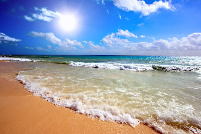
Seashore (Poem)

I sat by the seashore on the sand as my seat,
With the wind on my face and a wave at my feet.
Looking at yonder and the changing marine blues
Never even knew that there were so.. many hues!
The tides keep rising, bringing new ones near,
Washing the sandy beaches with waters sparkling clear.
The sounds of the waves – a music to my ear,
Are they, songs of the mermaids for me to overhear?
Children are playing with the fine trickling sand,
 Building moats and castles on the sun drenched land.
Shells and pebbles lie scattered on the shore,
Brought by the oceans as treasures to adore.
The seagulls keep teasing the everlasting wave,
And the clouds go a sailing all through the day.  
 I walk away home, but these memories linger on…
 Long after, my footprints on the sands are gone.

                                                                                                      (Picture from Google images)

Friday 9 March 2012

The Ghostly Village Of Kuldhara, Rajasthan(Untold Tales)


Kuldhara near Jaisalmer has a very strange story. It is believed that in the early 19th century there were 84 villages around Jaisalmer. The Paliwal Brahmin community which lived in these villages were farmers by occupation and were at the mercy of the king and his diwan (chief minister) for their taxes and peaceful livelihood.

The Ruins Of Kuldhara
About 400 odd years ago 
when the diwan was making his tour through the villages he saw the daughter of Kuldhara chieftain, who was drawing water from the well. She was a damsel of grace and beauty. He lusted over her and approached the chieftain to take her as his wife. The chieftain could not accept this proposal since the diwan was a married man with many vices. He requested the diwan a days time to think it over and answer him. 
The villagers knew that they had to choose between surrendering the girl to the lecherous diwan or continuously be tormented by him. The courageous farmers took a unanimous decision - to abandon their homes and leave the villages overnight. 
The locals say that they left behind a curse that anyone who lives on these lands would perish.Thenceforth these villages are uninhabited; Kuldhara has the most deserted look with heaps of bricks and dusty lanes. The ruined structures and the ghostly silence makes this place aptly called the “Haunted Village”.

The unity in the villagers decision and their unknown mode of the mass migration within the short period has left many puzzled till date. No one knew where they had moved, it is only a belief that since they were of Paliwal community they had moved to a place near Jodhpur called Pali. Some believe that they had migrated till Delhi and Agra.

But All Believe That The Curse Still Haunts There… 

Believe It Or Not..!!


Tuesday 6 March 2012

Shipbuilding Yard at Mandvi ,Gujarat (Unexplored Lands)


If one wants to see how the ships are built by craftsmen then a trip to Mandvi, a port town, located on the banks of the Rukmavati river, is a trip worth visiting. It lies about one km from the Arabian Sea at the Gulf of Kutch and about 56 km from Bhuj, (Gujarat).


This port town is said to be founded by the Khengarji, the king of Kutch in 1574. For more than 400 years, the shipbuilding industry has been the backbone for the locals at Mandvi. Mandvi was once the principal port of Gujarat, when ships from far and near used to trade here. The city used to have fortified walls around, but now, only a small portion of it remains. 

On the ship which was being built
With more modernized harbors like Mumbai and Surat which have larger shipping operations, Mandvi has now lost its status as a major shipping port in India. But the traditional method of building ships is still continued at this yard. One can visit this shipbuilding yard, where craftsmen assemble the huge ships with wood by hand, and we are at the liberty to watch them work and take photographs. A visit to this yard makes one appreciate the craftsmanship and skill involved and the laborious process of shipbuilding.

The other places of interest at Mandvi apart from the beautiful beach are-
The Mandvi Teerth which is a famous Jain pilgrim centre, dedicated to Bhagwan Shantinath. 
Vijay Vilas Palace which has umbrella shaped domes and cupbolas of the the Bengali and Rajastani style of architecture.
The Wind Farm Beach known for its wind mill project, which was established in 1983 as the first wind energy project in Asia.

Kettuvallams of Alleppey, Kerala (Travelogue)


" Boats sail on the rivers, 
 And ships sail on the seas; 
       But clouds that sail across the sky 
        Are prettier far than these."
                                                     Christina Georgina Rossetti

Nearly every poet has written a poem about boats and streams and I always wondered why it captured a moment of spell in them- until I took the boat ride on the backwaters of Alleppey.
Kettuvallam on the backwaters
The kettuvallams (Kerala houseboats) in the backwaters of Alleppey are one of the most prominent and exciting tourist attractions of Kerala. More than 2000 kettuvallams ply in these backwaters and this place is rightly called "The Venice of the East".
View of a house boat on the lagoon
In a water bound land of Kerala it must be the most common sight for the locals of this region, but for a visitor to cruise in a houseboat,which glides along the vast expanse of the brackish lagoons for a full day and night; is one of the most amazing spectacle to be experienced.
A bridge across the canal connecting the backwaters
Even more enchanting is when its a complete holiday package delivered in these Kettuvallams-which are equipped with all the necessary facilities, caters to all needs such as delicious food and tidy rooms and provide the most exotic kaleidoscopic scenery changing right before our eyes (as three sides of these boats are open).
Cup of chai with the misty morning as a backdrop
The breath taking views of the land and the habitats on either sides, the water birds and the soft ripples of waters all around-this journey on waters is sure to make even a layman pen down a few poetry.

Saturday 3 March 2012

A Trip To Sholaiyar Dam, Tamil Nadu (Unexplored Lands)

One particular weekend, we decided to embark on a road trip to Sholaiyar Dam, enticed by the tales of its breathtaking scenery along the Pollachi-Valparai-Sholaiyar Dam route. To avoid the weekend traffic, we set off early and relished in the delightful weather as we passed by rows of windmill turbines in the Pollachi-Udumalpet area.

The Windmills On the way 

As we ascended the Ghat road of the Annamalai hills, we were captivated by the tea estates that blanketed the hills like green carpets. Upon reaching Valparai, we swiftly dined at a local eatery before making our way to the Sholaiyar IB guest house for our weekend retreat.
The guest house afforded us a magnificent view of the Sholaiyar Dam, which stands as one of the deepest dams in all of Asia. Our time was spent strolling through the tranquil surroundings, marveling at the dam's beauty, as well as the nearby Upper and Lower Nirar dams.

The View Of The Tea Estates
Situated on the border of Tamil Nadu and Kerala, on the Chalakudy River, this dam serves as a crucial reservoir within the Parambikulam Aliyar Project, boasting a water storage capacity of 160 ft. The excess water from the reservoir is channeled into the Parambikulam Reservoir through the saddle dam. Although it attracts numerous tourists during evenings and weekends, only a select few opt to prolong their stay in this serene locale. It is an ideal destination to relish in the fresh air and tranquility of a laid-back village. The path utilized by the locals to access the opposite end of the dam offers picturesque and breathtaking vistas.

Dam From IB Guest House
In the vicinity of Sholaiyar, there are two noteworthy dams - the Upper Nirar and Lower Nirar dams. The Upper Nirar Dam collects water from the Chinnakallar falls and transports it through a tunnel to the Lower dam. Nestled amidst dense forests, it is a truly enchanting place to visit. Both dams possess their own unique allure, and one can easily spend hours exploring their surroundings. These dams are certainly worth a visit, prompting us to ponder the remarkable skills and labor that were employed in constructing them years ago, primarily for hydro-power and irrigation purposes.
The Dam - view from the other side 


Friday 2 March 2012

The New English


English language is the most notorious for adapting to the fast changes in the world. New words are added and get embedded in the regular lingo of the young gen now a days.
With a list of new words coined recently, we may be speaking this way in a few years to come –

“Me being funemployed decided to go for a daycation with a friend who is a freemale to my sis’s place as she was in a sandwich generation. On entering her house we paid respects to her FIL who was scanning few snailmails and her MIL who was engrossed with an outernet. Her teen daughter an infomania was wearing a hoodie in April, calling herself a fashionista, was applying a nail tat with her eyes glued to her netbook. My sis a sofalizer was busy with her laptop and her little one had already become a cot potato.
We had some chicken biryani for lunch as we were flexitarians and spent most of the time catching up with the buzz under the jumbrella in her lawn sipping on an alcopop. We left her place late evening but could not meet my BIL as he had become a member of the overworking class as his company was decruiting since the year beginning.
My sis assured us that she’d make it for the staycation we were planning with few more friends at an agritourist place and said she’d send her kids for a greycation during the winterval. We reached home safe without being carjacked or encountering a flashmob en route.”


Dear netizen, if you have difficulty in deciphering the content of the passage refer the key below:-

Agritourism   A form of tourism in which tourists stay on farms or in agricultural  villages, and often participate in farm activities.  
Alcopop Fruit drinks fortified with alcohol, designed and marketed to appeal  to young people.

Buzz  Excited interest or attention surrounding, for example, a new invention,  a recent event or something that has become fashionable.

Carjacking-  Blend of 'car' and 'hijacking',  When a car driver is forced to give up his vehicle or drive to a
destination designated by the attacker.
Cot potato Very young child who spends a lot of time watching television.  (cot = a baby's bed)

Daycation A trip or short vacation which lasts only one day - daycationers do not stay away overnight.
Decruitment Euphemism for laying-off staff or downsizing a company.

Fashionista  Person who dresses according to the latest fashion trends.
Flash mob  A crowd that gathers in a pre-determined place, performs an action then disperses very quickly. The mob is not told exactly what to do until just before the event.
 Flexitarian A vegetarian who sometimes eats meat or fish
 Freemale  A woman who is happy to stay single and independent so that she can do what she wants when she wants.
 Funemployed A blend of 'fun' and 'unemployed'.Someone who enjoys not having a job because they have more time for leisure and fun activities.

 Greycation Going on holiday or vacation with grandparents in order to reduce the cost.

 Hoody or hoodie  A person, especially a youth, wearing a hooded top.

 Infomania Constantly checking and responding to email and text messages.

Jumbrella Blend of 'jumbo' and 'umbrella'. Very large umbrella set above tables outdoors at a coffee shop,
 pub or restaurant.

 Nail tat A temporary tattoo applied to the nails.
 Netbook Small laptop computer which weighs less than 3 pounds and has a 7 to 10 inch screen.
 Netizen  Blend of 'internet' and 'citizen'. A person who spends an excessive amount of time on the internet

Overworking class A segment of today's working population where there is a desire or need to work long hours.
Outernet Traditional media (newpapers, magazines, radio, television) as opposed to the internet.

Sandwich generation A generation of people who care for the needs of their children as well as those of their own elderly parents.
Snail mail The standard system of delivering mail which is very slow in contrast  to electronic mail.
Sofalise/sofalize  Stay home and use the internet, phone or other electronic device to communicate with people (social networking, chatting, tweeting, etc.),  rather than go out and meet them face to face.  Staycation A vacation in which you stay at home and relax or visit places close to where you live.

Winterval  Blend of 'winter' and 'festival'.  A festival that takes place in winter.